

if you cannot find answer to your question our FAQ, you can alwas contact us. web will answer you shortly!
At AIM United, we believe that precision is power. Every successful project begins with clarity, and our newly acquired surveying and laser-scanning division is dedicated to providing that clarity at every stage of design, construction, and operation.
By combining cutting-edge technology, a skilled team of survey engineers, and a client-centric approach, we deliver high-accuracy data that becomes the foundation for smarter decision-making, efficient planning, and reduced project risks. Whether you are designing a new development, upgrading existing infrastructure, or preserving historical landmarks, our services give you the reliable information you need to move forward with confidence.
Our 3D laser scanning solutions use advanced stationary, mobile, and handheld scanners to capture millions of data points in minutes — producing a highly accurate digital twin of your site.
We generate precise point clouds that document existing conditions down to the smallest detail, enabling stakeholders to:
Validate design assumptions before construction begins
Detect potential conflicts early to avoid costly rework
Plan renovations and upgrades with confidence
Preserve a permanent digital record of the site
This service is ideal for complex projects such as high-rise buildings, manufacturing facilities, industrial plants, airports, and heritage sites.
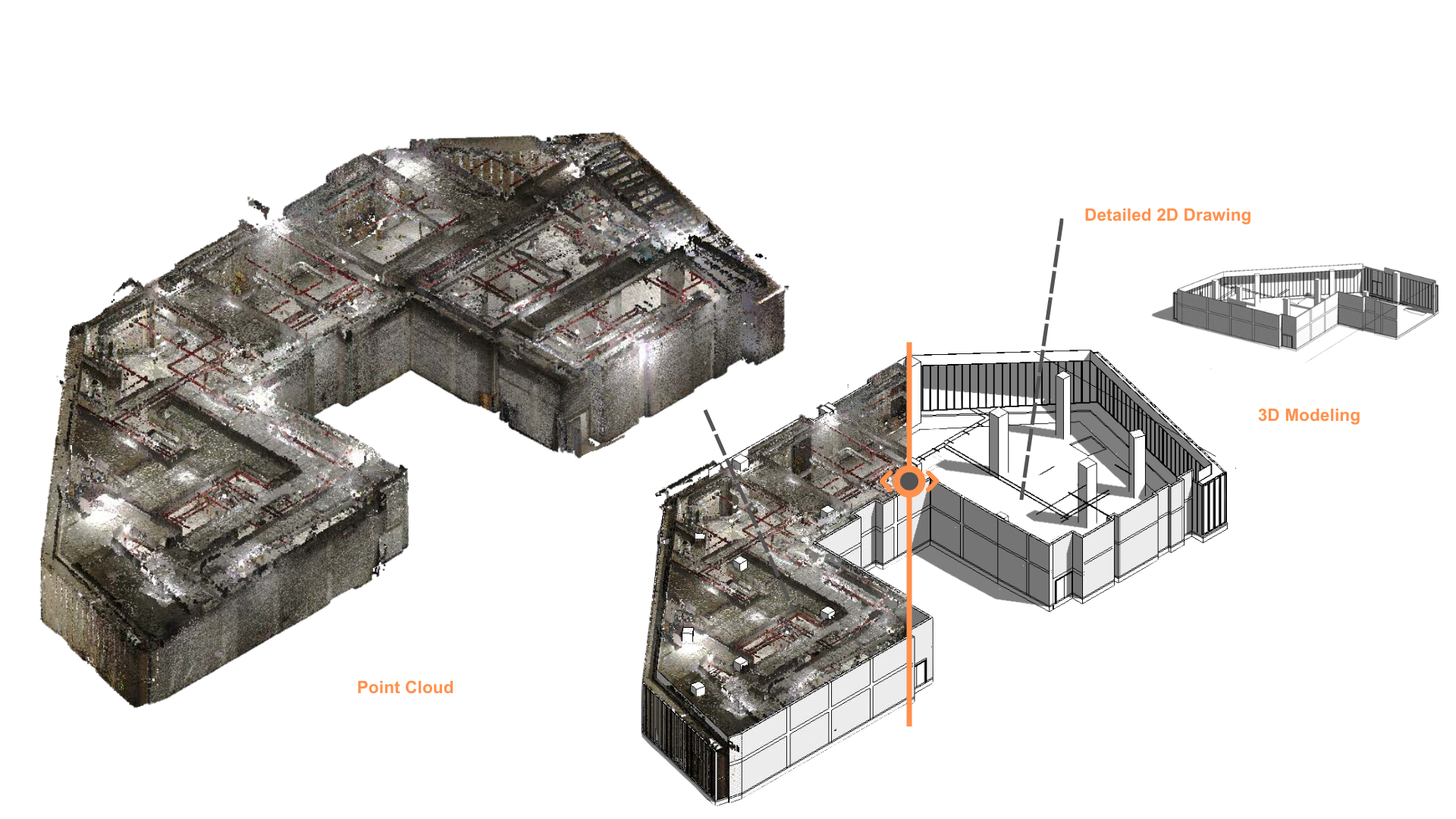
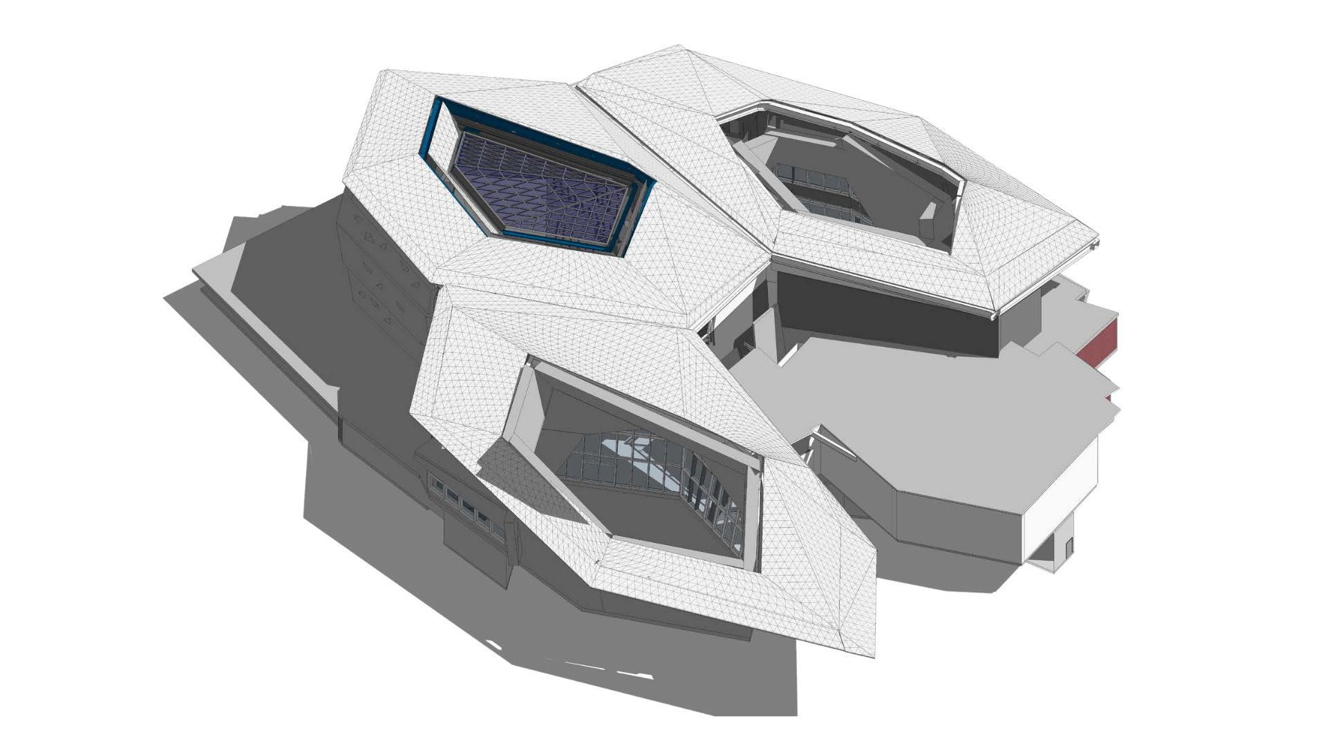
Our team transforms raw point cloud data into LOD 500 BIM models and construction-ready 2D drawings, making it easy for designers, contractors, and facility managers to work from a single source of truth.
With BIM as-built documentation, you can:
Verify field conditions before issuing IFC drawings
Simplify coordination across multiple disciplines
Optimize facility management with accurate spatial data
Use the model for future renovations and expansions
Whether you are coordinating MEP systems in a tower, planning a hospital expansion, or producing a master plan for a residential complex, our BIM deliverables save time, reduce RFIs, and support better outcomes.
For large-scale projects, we deploy RTK drones, LiDAR sensors, and GPS ground stations to capture high-resolution aerial imagery and generate topographic data.
Our aerial mapping services deliver:
DSM & DEM models for slope stability and earthworks planning
Orthophotos and contour maps with centimeter-level accuracy
Complete site documentation for infrastructure projects
These surveys are particularly valuable for urban planning, industrial zone development, highway alignments, mining, and environmental monitoring.
Accidental strikes on buried utilities can be dangerous, costly, and disruptive. Our underground detection service maps subsurface utilities (water, electrical, telecom, gas) with precision, helping your project team avoid surprises and maintain safety compliance.
Preserving history requires accuracy. We specialize in Heritage Building Information Modeling (HBIM), combining 3D scanning with detailed mesh modeling to document heritage sites with extreme accuracy.
Our work supports ministries, municipalities, and restoration architects with:
3D models for renovation and conservation planning
Precise drawings for repair and reconstruction
Long-term digital archiving of culturally significant sites
Our portfolio includes documentation of centuries-old mosques, palaces, and historic houses across Saudi Arabia and Egypt.
Before final handover, it is crucial to confirm that MEP systems, finishes, and interior works match design specifications. Our scanning process allows us to compare installed systems with design models, detect deviations, and issue reports for corrective action — minimizing costly post-handover issues.
We pride ourselves on delivering not just data, but decision-ready information. Our deliverables include:
Point Clouds (LAS, PTS, E57) for design and coordination
BIM Models in Revit or other required formats
Detailed 2D Drawings for construction or tendering
Quantity Take-off & BOQ reports for cost estimation
Orthophotos, Contour Maps, and Grid Plans
High-quality Renderings to visualize results for stakeholders
Our surveying and laser scanning division has contributed to some of the most high-profile projects in the region:
Black Gold Museum – Riyadh: Interior scanning of museum spaces with over 700 FARO scans, delivering a complete LOD 500 BIM model.
King Abdullah Financial District: Scanning and MEP verification for iconic towers and atrium spaces.
Louis Vuitton Flagship Store – Riyadh: Detailed scanning for fit-out planning and interior design.
Capital Market Authority Building: 3D model creation used for cladding BOQ and tendering.
Shahin Al Khalwati Mosque & Najran Historical Houses: HBIM documentation for restoration and preservation.
Residential Compounds & Villas: Complete master planning with as-built documentation and landscape modeling.
No matter the scale — from a single retail unit to a 1,000-villa master plan — we approach every project with the same level of precision, integrity, and commitment to excellence.
At AIM United, we don’t just measure spaces — we deliver clarity that drives smarter, faster, and more cost-effective decisions.
AIM is your trusted partner in construction and design, specializing in residential, commercial, and infrastructure projects with a focus on BIM.
Copyright © 2024 AIM United. All Rights Reserved.