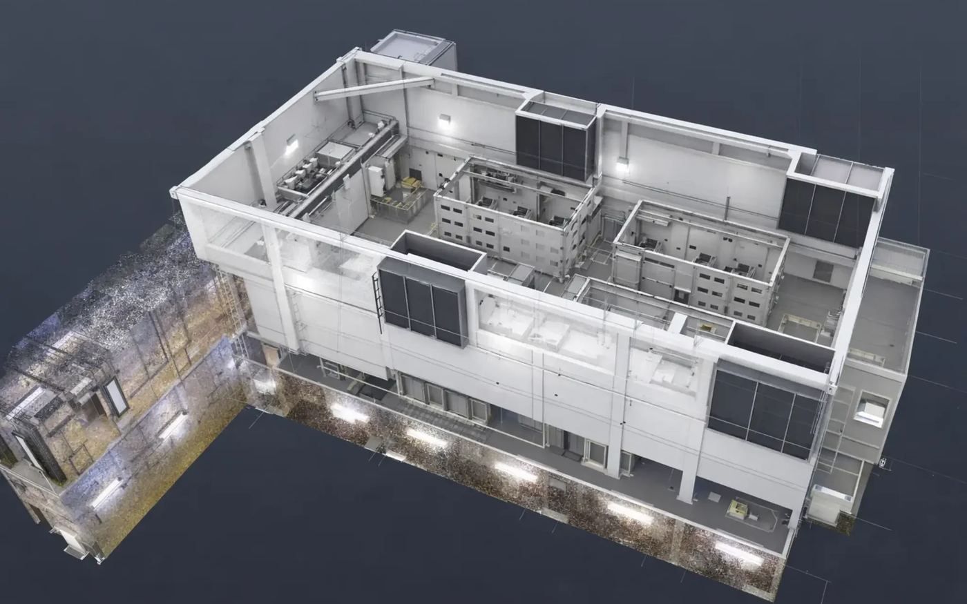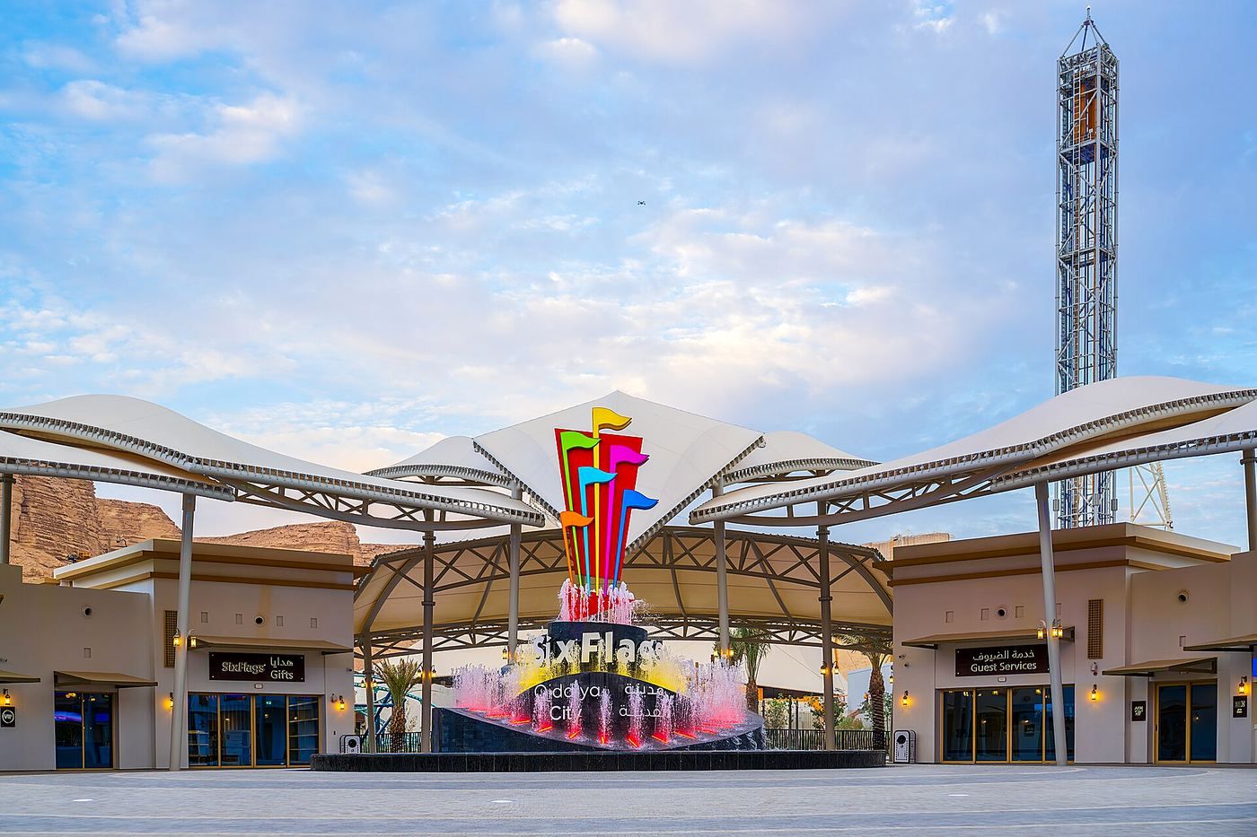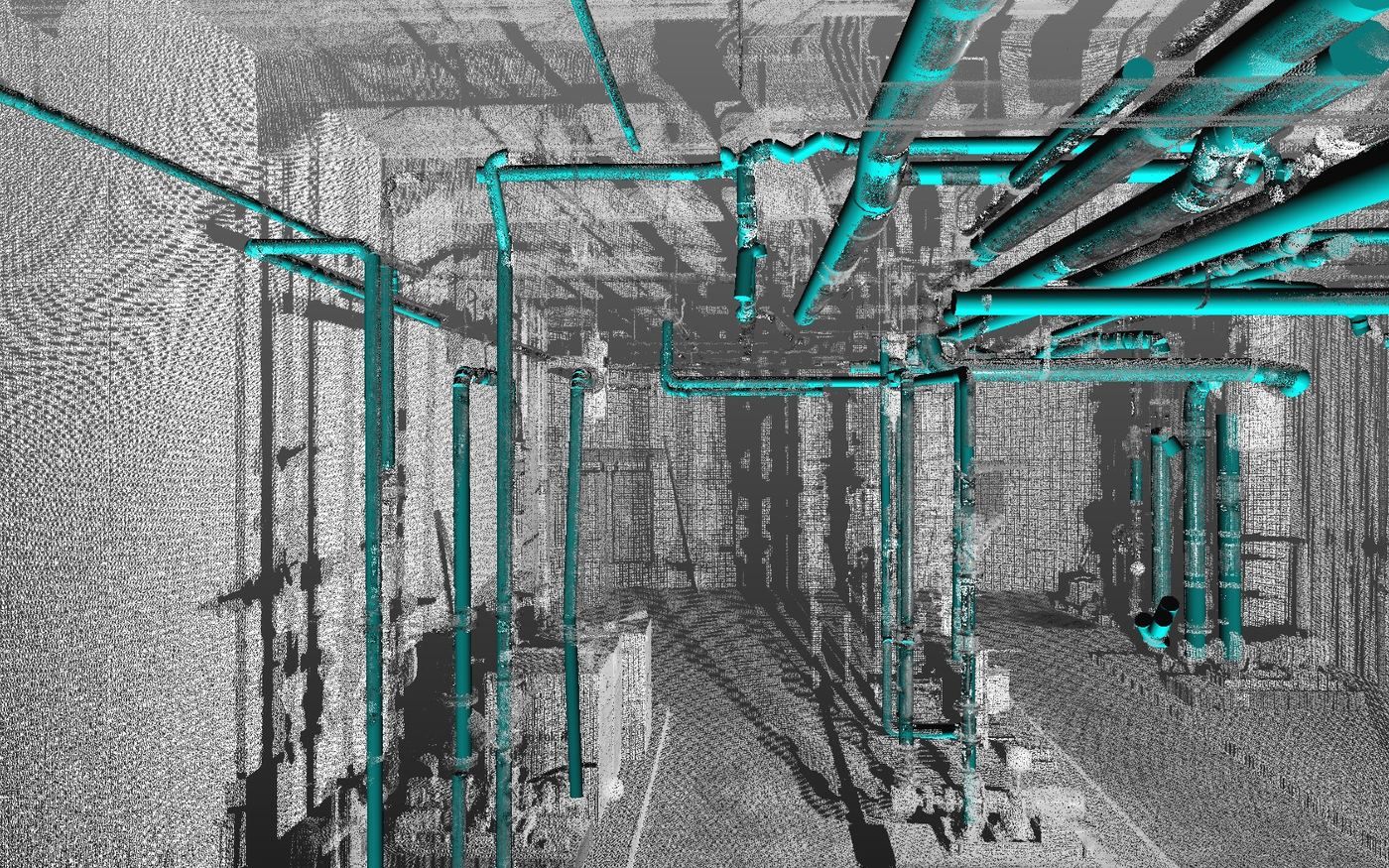

Scan to BIM for heritage buildings in Saudi Arabia solves a basic problem: most historic buildings in the Kingdom have no reliable drawings, and the ones that exist rarely match what stands today. A laser scan measures the building as it is, in millions of points. A model built from that scan gives architects, engineers and conservators a common, accurate base to work from.
The same method applies to any existing building, from a century-old house in Najran to a bank headquarters in Jeddah.
Why does Saudi heritage need accurate digital records?
Restoration work in the Kingdom is growing fast. At-Turaif in Diriyah was inscribed on the UNESCO World Heritage List in 2010, and Historic Jeddah followed on 21 June 2014, according to Saudipedia. Historic Jeddah holds around six hundred historic buildings. In 2021 the Crown Prince launched the Historic Jeddah Rejuvenation Project, and Arab News reported in March 2024 that a separate royal donation had funded the rescue of historic Jeddah buildings close to collapse, with the work carried out by five Saudi specialist companies.
Restoring a building safely starts with knowing its geometry: wall thicknesses, out-of-plumb surfaces, cracks, settlement, the exact profile of carved openings. Hand measurement of irregular mud-brick or coral-stone walls is slow and misses detail. A scan captures it in hours.
What is scan to BIM?
DefinitionScan to BIM is the process of capturing an existing building with 3D laser scanning (and often drone photogrammetry), registering the scans into one point cloud, and modelling the building's elements in BIM software against that point cloud.
The process has four steps:
- Capture. Terrestrial scanners on tripods record interiors and facades. Drones with LiDAR or cameras record roofs and sites. Survey control ties everything to coordinates.
- Register. Software aligns the individual scans into one point cloud and reports the alignment error.
- Model. Modellers trace walls, floors, roofs, openings, structure and services against the cloud, at the agreed level of development.
- Check. A deviation report compares the model with the point cloud and shows where and by how much they differ.
When the model is checked against the point cloud this way, it meets the field-verified idea behind LOD 500. Our article on LOD 300 vs LOD 400 vs LOD 500 explains why that matters.
What is heritage BIM (HBIM)?
HBIM applies BIM to historic buildings. Each element carries information a conservator needs: material, construction technique, condition, date of any intervention. Saudi researchers are building methods for it. A 2025 paper in the ISPRS Archives, co-written by an author from the Heritage Commission and an author from King Abdulaziz University, sets out an integrated model combining HBIM, laser scanning and GIS, with case studies in Al-Balad in Historic Jeddah, At-Turaif in Diriyah and the mud-built structures of Al-Qassim.
Skills are building up too. In November 2025 the Heritage Commission and a Japanese conservation centre ran a three-day workshop at the National Museum in Riyadh where 25 specialists practised 3D photogrammetry, smartphone LiDAR and 3D laser scanning. At Diriyah, a Geospatial World case study reports that the development authority uses GIS, BIM and other geospatial tools.
Three Saudi heritage surveys by AIM United
All three sit on the AIM United projects map, with their photos and scope.
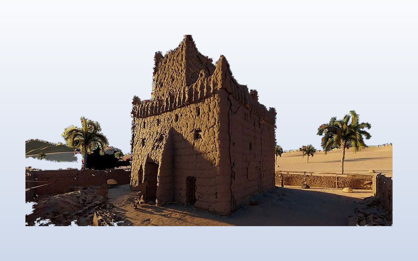
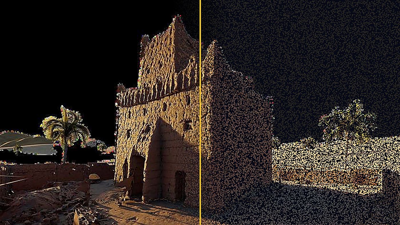
Najran Historical Monument
A century-old monumental house and local landmark in Najran. AIM United scanned it in full detail in 2024 to support its renovation. The coloured point cloud records the tapering mud walls, the decorative bands at each floor and the parapet profile, which a drawing would struggle to show.
Bayt Ba Jafar, Al Qunfudhah
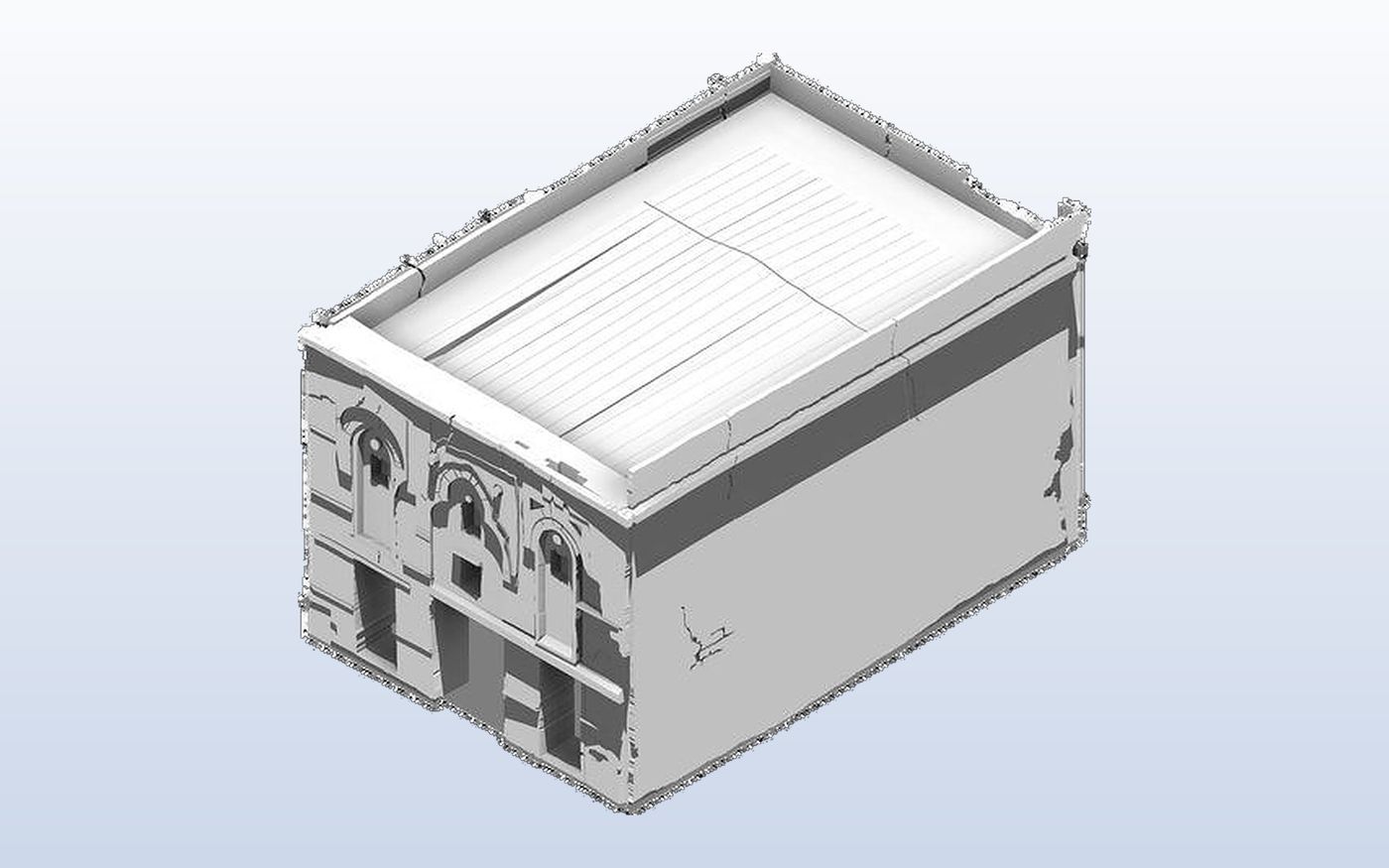
A historic building on the Red Sea coast, scanned in 2024 to support its renovation and preservation. The scan recorded the effects of age and weather on the facade and its carved openings. From the point cloud, the team built a 3D model of the building's current state for the restoration designers.
Al-Diriyah Industrial Zone
Not every survey is a monument. In 2024 AIM United flew a drone LiDAR survey over an existing industrial zone in Al Diriyah at a ground sampling distance of 2.6 cm per pixel, to produce plans of the existing structures and landscape. Large sites like this are faster to capture from the air, then detail is added from the ground where needed.
Outside the Kingdom, the team scanned the Shahin Al Khalwati Mosque in Cairo, built in 1523, to millimetre detail for conservation and restoration.
The same method for modern buildings
Heritage is only part of the work. Most scan to BIM jobs in the Kingdom are modern buildings where the drawings no longer match reality. A few examples from AIM United's recent work in Riyadh:
- KAFD Atrium (Parcel 5.05): static scanning of an irregular atrium to a Revit model, used to fabricate custom steel supports and install GRP cladding on inclined steel tubes.
- Capital Market Authority building: scanning to a Revit model for an exterior redesign, used at tender to measure cladding areas for the bill of quantities.
- Crystal Towers: an interior scan of 5,700 m² across four floors, for a review of MEP and construction details.
In each case the scan replaced weeks of manual measuring, and the model gave fabricators and estimators dimensions they could trust.
What should an owner specify before scanning?
Most scan to BIM disputes come from an unclear brief. Write these down before the survey team arrives:
- Accuracy. State the required accuracy band for the survey. The US Institute of Building Documentation publishes a Level of Accuracy specification that many surveyors use for this.
- Coverage. Which rooms, roofs, facades and voids must be captured, and which are out of scope.
- Model LOD and elements. Which elements to model, at which level, and how decorative detail is handled: modelled, meshed from the cloud, or left in the point cloud for reference.
- Deliverables. Registered point cloud, BIM model, 2D drawings, deviation report, and the file formats for each.
- Information. For HBIM, which condition and material data to attach to each element.
For occupied buildings, plan scanning around the building's use. On Bank AlJazira's headquarters in Jeddah, AIM United is scanning a working building to produce a validated LOD 500 model. See our Saudi BIM case studies.
What happens after the model is built?
The model becomes the base for the restoration design, structural assessment and MEP upgrades. For a building that will be used again, such as a museum, hotel or visitor centre, the model can carry on into operations as the asset record and, with sensors, into a digital twin for facility management.
AIM United's 3D laser scanning and scan to BIM team surveys with terrestrial, mobile and drone LiDAR, and our as-built team delivers LOD 500 models with asset data. For visitor-facing heritage projects, the same model can drive VR walkthroughs for design review and interpretation.
Frequently asked questions
How accurate is a laser scan of a building?
It depends on the scanner, the distance, the surface and the registration method. Agree a required accuracy band before the survey, and ask for a registration report and a deviation report that compare the model with the point cloud.
Does scanning damage heritage buildings?
No. Terrestrial laser scanners and drones measure without touching the surface. The survey team only needs safe access to stand the scanner at each position.
What is HBIM?
Heritage or historic building information modelling: BIM applied to existing historic buildings, usually modelled from a laser scan, with information about materials, condition and interventions attached to each element.
Need an accurate record of an existing building?
AIM United scans heritage sites, occupied offices, malls and plants with terrestrial, mobile and drone LiDAR, and models them in Revit from LOD 200 to LOD 500 with deviation reports.
Sources
- List of Saudi heritage sites inscribed in UNESCO, Saudipedia, accessed 6 October 2026.
- Historic Jeddah, Saudipedia, accessed 6 October 2026.
- Project to save historic Jeddah buildings completed thanks to SR50m from Saudi crown prince, Arab News, 29 March 2024.
- Digital architectural heritage in Saudi Arabia: an integrated model for documentation and preservation, ISPRS Archives (Mulush and Baik), 2025.
- 3D digital documentation workshop with the Saudi Heritage Commission, National Museum, Riyadh, Tokyo National Research Institute for Cultural Properties, November 2025.
- Revitalizing Al Diriyah: integrating GIS, BIM and 4D solutions for historic urban development, Geospatial World, undated, accessed 6 October 2026.
- Level of Accuracy (LOA) Specification, USIBD, version 3.1, accessed 6 October 2026.
- Level of Development Specification, Version 2017 (reprint), BIMForum, 2017.
Links checked on 6 October 2026. Regulations change: confirm current requirements with the issuing authority before you rely on them.
 Written by the AIM United BIM team in Jeddah. AIM United delivers BIM, scan to BIM, digital twins and design-build across Saudi Arabia.